Facilities Available:
Geomatics Division is equipped with state-of-art hardware and software facilities in a networked environment for data input, analysis, design and display with all required peripherals like workstation, scanner, plotters, printers & other back up devices. The set-up comprises of the following:
|
ERDAS IMAGINE v2022, Corel Draw, e-Cognition |
|
ArcGIS Advanced 10.8.2/ ArcPro V3, ArcInfo 10.8, QGIS, Auto CAD Map |
|
Pix4D, AgiSoft, Global Mapper, Leica LPS Suite |
|
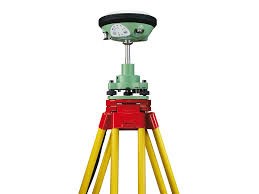
Leica GS 25 and GS 16 (Multi-frequency DGPS); Leica Infinity Software |
|
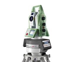
RIEGL VZ-4000, S/W Riscan pro |
|
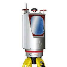
DMT Gyromat-3000 |
|
Survey Grade Drones – Quadcopter, Hexacopter & Fixed Wing along with Different Payloads (Optical, Thermal & LIDAR) |
|
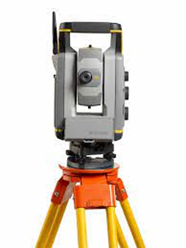
Leica TS-13, Trimble S7, Topcon DS 101AC; Liscad Software, TBC Advanced Software, Topcon Magnet |
|
Plotters, Printer, Scanners, Workstations etc. |
|
GPS - Leica GS25 |
ETS-Trimble S7 |
|
3D TLS - RIEGL VZ4000 |
Gyromat-3000 |
|
Survey Grade Drones |
|