Services Offered:
CMPDI offers its Geomatics services in all the three stages of mining i.e. pre-mining, syn-mining and post-mining ranging from topographical survey, mineral exploration, environmental management planning to excavation measurement, land reclamation monitoring, erosion and siltation, coal mine fire, land subsidence measurement and Drone based applications.
|
Surveying |
All types of Surveying jobs are undertaken by CMPDI using latest survey equipment viz. Terrestrial Laser Scanner (TLS), Differential Global Positioning System (DGPS), Electronic Total Stations (ETS), Gyroscope etc. |
|
|
|
OBR / Excavation Measurement |
OBR measurement in OC mines of different subsidiaries of CIL and outside clients, using Terrestrial Laser Scanner on regular basis. Earth excavation in civil construction can also be measured with laser scanner. |
|
|
|
Geo-referencing of Boundary for Forest Clearance, using DGPS |
|
Churi UGP, CCL |
|
|
Vegetation Cover / Land Use Mapping |
Vegetation cover/ Land Use mapping of 19 major coalfields are being carried out for creating geo environmental database and to assess impact of mining and associated industrialization on land environment by analyzing temporal satellite data.
|
Land use/vegetation cover mapping of Singrauli coalfield based on satellite data. |
|
|
Land Reclamation Monitoring
|
Satellite surveillance for land reclamation of all the OC mines of CIL are carried out on annual basis for assessing the progressive status of mine land reclamation and for taking up remedial measures, if any, required for environmental protection. |
Land reclamation in Piparwar |
|
|
|
Mineral Exploration |
Regional geological and structural mapping are carried out for locating the potential coal/mineral bearing zone for detail exploration planning.
|
Geostructural mapping for locating potential coal bearing zone in N-W part of IB Valley Coalfield, MCL |
|
|
Coal Mine Fire Mapping |
Methodology for mapping of Thermal anomalous area due to coal mine fire using Airborne Thermal Scanner (Daedalus-1268) data was first developed by CMPDI in collaboration with NRSC, Hyderabad way back in the year 1992. Later, Coal mine fire mapping was carried out using ASTER/LANDSAT 8 thermal band data for Jharia, Raniganj, Bokaro and Karanpura coalfields on annual basis between 2012 to 2017. Thermal Mapping of Chirimiri Coalfield is being carried out using Satellite Data since 2024 Recently, Drone acquired TIR Data was used for mapping of Thermal anomalous areas due to coal mine fire in Kuju OCP, CCL |
Thermal map showing mine fire in Jharia Coalfield |
|
|
Environmental Management Planning |
Land use/cover pattern in core and buffer zone based on satellite data for EMP of mining projects as per MoEF mandate.
|
|
|
|
Watershed Management |
· Hydrogeomorphic mapping for locating the potential ground water zone in different coalfields and other parts of the country are carried out based on satellite data. · Watershed management study for effective utilization of water resources · Water resource survey and hydrological study. |
Mapping of potential ground water zone in Karanpura Coalfield based on satellite data. |
|
Reservoir Sedimentation Assessment |
Data from space platforms play a significant role in reservoir capacity estimation surveys. CMPDI conducted the sedimentation assessment in Govind Ballabh Pant Sagar near Singrauli Coalfield for different cut-off periods. |
Siltation assessment in GBP reservoir |
|
|
Sodic Land Mapping |
Due to excess use of chemical fertiliser and canal irrigation, soil salts precipitated at the surface and make the land barren. CMPDI has developed the methodology for cadastral level sodic land mapping based on high resolution satellite data for UP Bhumi Sudhar Nigam Ltd. Sodic land mapping in Pratapgarh and Allahabad districts was carried out as pilot project for UPBSNL. |
Cadastral level sodic land map of Rendigarpur village, Pratapgarh District. |
|
|
Correlation Survey in Underground Coal Mine having Shaft Entry using Gyroscope |
Gyroscope is used for transfer of Ground Coordinates into an Underground Mine having Shaft entry through Gyroscopic Survey. |
|
|
|
Tunnel Alignment using Gyroscope
|
Tunnel Alignment in Udhampur-Baramulla-Srinagar Rail Link Project, J&K and Sivok-Rangpo Rail Line Project, West Bengal, using GYROMAT 3000. |
|
|
|
Alignment Survey Using Gyroscope |
Alignment of Systems in Navy’s Ship at Mazegaon Dock with the help of Gyroscopic System (March-April 2009) |
|
|
|
Settlement Mapping |
High resolution Satellite Data is used to map settlements for R&R. |
|
|
|
Site Selection for TPS, Washeries and other Industrial Units |
CMPDI has established a methodology for locating the potential TPS sites using Geo Spatial technology in India for Central Electricity Authority, Govt. of India. More than 120 TPS & UMMPs sites were located by CMPDI including pit heads, load centers and coastal areas. Most of the UMMPs are coming on the sites selected by CMPDI. |
|
|
|
Major project of National Importance |
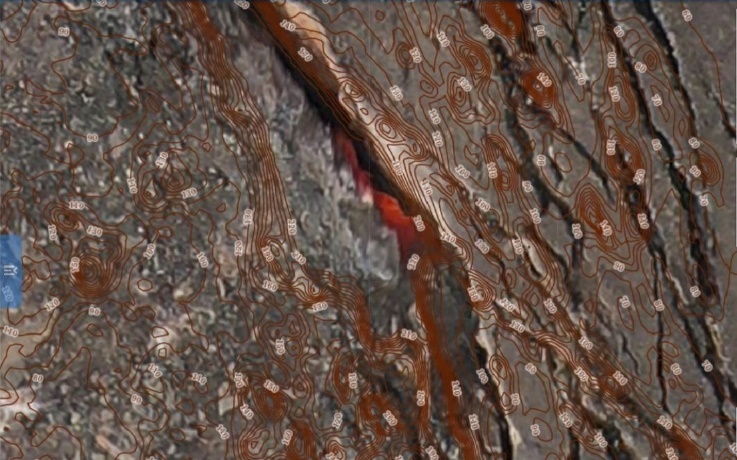
Topographical survey of 27 major coalfields on scale 1:5000 with 2m contour interval in plains and 3-5 in hilly terrains based on Remote Sensing Technique for detail exploration, mine planning and infrastructure development completed in association with Survey of India.
|
Large Scale Topographical Map |
|
|
Survey of Infrastructure, Colonies |
|
||
|
Geo-referencing of Coal Block Boundary and Cadastral Map |
|
||
|
Development of MoC page on PM Gati Shakti – National Master Plan, in association with BISAG-N |
|
||
|
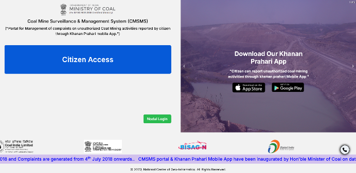
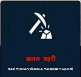
Development of Coal Mine Surveillance & management System (CMSMS) web platform and Khanan Prahari Mobile App for reporting and taking action on illegal activity in a mine, in association with BISAG-N |
  |
|
|


| Drone Application Areas | |
| Preparation of Orthophoto-mosaic and Contour Maps | 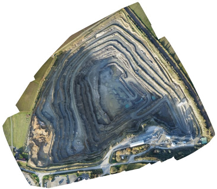
|
| Vegetation Cover Mapping | 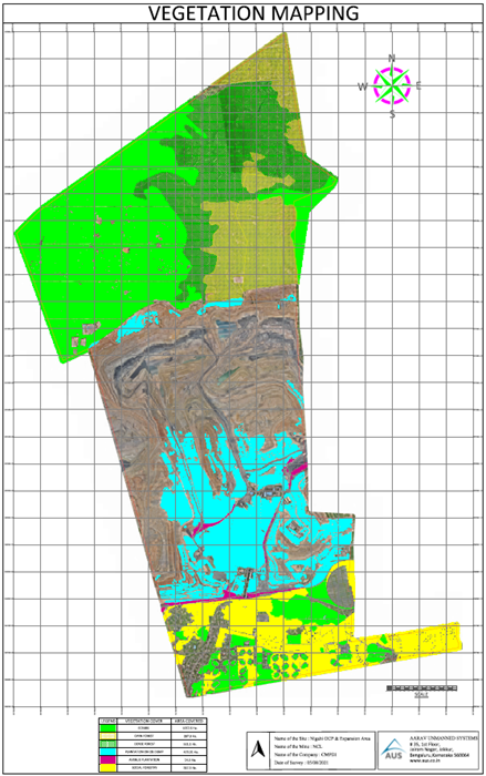
|
| Generation of Orthophoto Mosaic for Settlement Mapping | 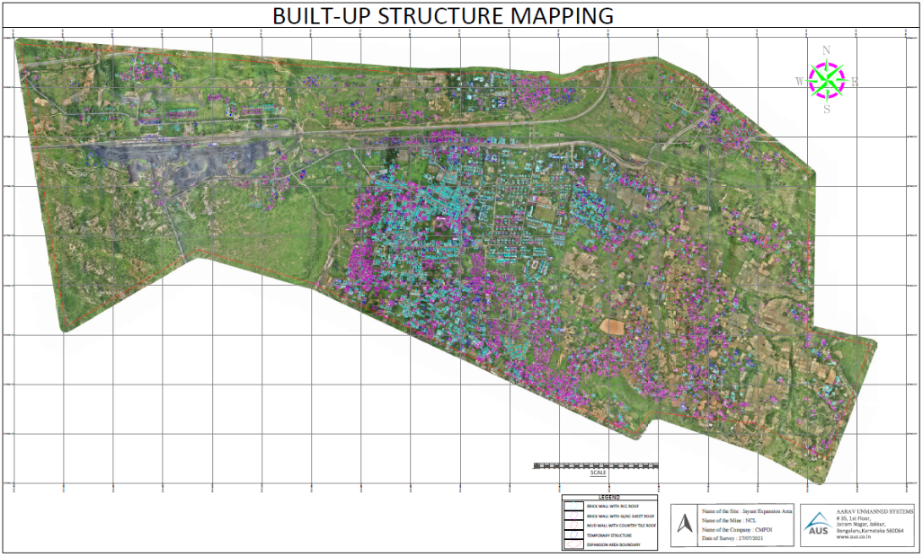
|
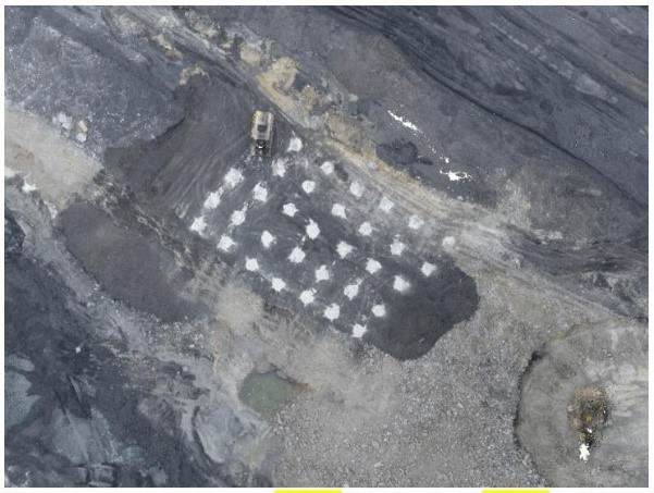
| Blasting Monitoring |
|
| Inspection of HEMMs/Civil Structures and other inaccessible areas | 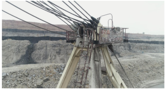 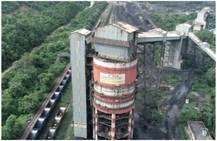 |
| Plantation Height Assessment | 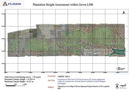 |
| Sand Replenishment Study in the States of UP, Bihar and Rajasthan | 
|
| Coal Stock Volume Measurement | 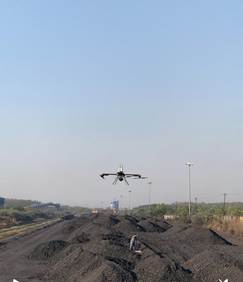 |